
VOLUME 01 ISLAND INSIGHT • CHAPTER 03
How Geography Shapes Life on Nusa Lembongan and Ceningan
On small islands, coastlines, tides and distance do more than shape the view. They shape how people live, move, build and do business.
- August 10, 2026
- 7 Minutes Read
Nusa Lembongan and Ceningan are often introduced through beaches and sea views. That is only the surface. The same geography also decides where boats can land, how supplies move inland, where settlements have grown and why two places only minutes apart can operate in very different ways.
Two islands that work as one daily system
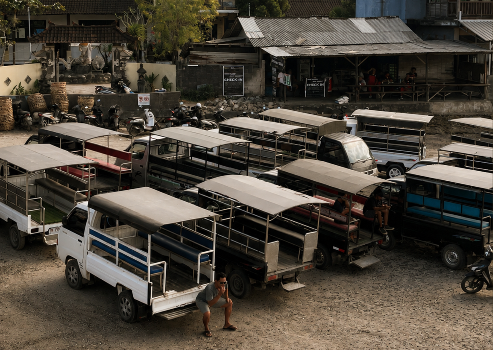
Nusa Lembongan and Ceningan are separate islands, but daily life moves between them as one connected system. The Yellow Bridge carries people, scooters, smaller supplies and working relationships across the narrow channel. A resident may live on Nusa Ceningan, work on Nusa Lembongan and cross again for fuel, family or a ceremony without treating the journey as a trip between separate destinations.
Geography creates closeness, but it also creates dependency. A short distance on a map can still rely on one bridge, one narrow road or one coastal landing. When those links work, the islands feel compact. When one is interrupted, the effect quickly reaches schools, workplaces, deliveries and households on both sides.
Water decides how movement begins
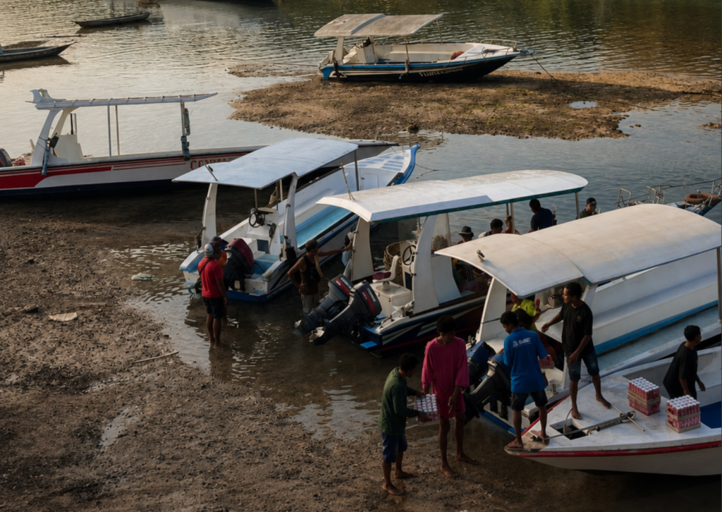
Most journeys to the islands begin on water, but not every arrival point serves the same purpose. Jungutbatu is one of Nusa Lembongan’s main passenger arrival areas and sits close to accommodation, restaurants and local transport. Mushroom Bay serves another important visitor route, while working landings and coastal access points support cargo, fuel and local boat movement. Wind, tide, swell, beach conditions and boat type can affect where people and goods arrive.
Once ashore, almost everything continues by road, scooter or smaller local vehicle. Food, fuel, building materials and household supplies must be unloaded, sorted and carried towards villages and businesses. Coastal access is therefore not only an arrival experience; it is the first working link in the islands’ supply chain. Local operators read sea conditions, landing space and road access together, not as separate systems.
Different coasts create different island experiences
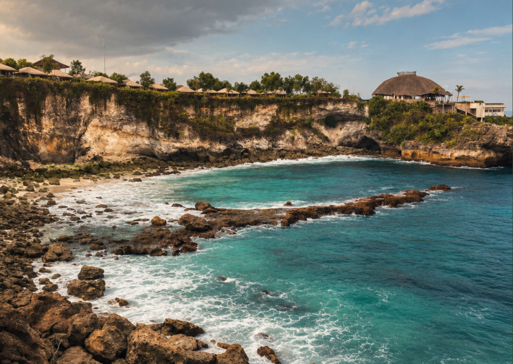
The north and northeast of Nusa Lembongan are shaped by mangroves, tidal shallows and more protected water. Around Jungutbatu, a long developed shoreline supports passenger arrivals, accommodation and marine activity. Further south, Mushroom Bay offers a more enclosed landing area, while the channel near the Yellow Bridge becomes a working meeting point between Nusa Lembongan and Ceningan. On Nusa Ceningan’s outer edges, cliffs, reef lines and open-water exposure create a very different coastal character.
Each coast supports different possibilities and carries different limits. Sheltered water may suit landing, farming or lower-impact marine activity. An exposed coast may offer dramatic views but requires closer attention to wind, salt, erosion, drainage and safe access. Geography does not make one area automatically better; it determines what can work there responsibly.
The land has practical limits
Small islands leave little room for infrastructure problems to disappear. Roads, drainage, water storage, waste movement, electricity, parking and construction logistics all compete within a limited footprint. In Jungutbatu, visitor movement and local business concentrate along already active roads. Near the Yellow Bridge, one narrow crossing carries daily traffic between two islands. On steeper or more exposed parts of Nusa Ceningan, access, drainage and material delivery can become part of the site challenge itself.
This is why a site must be understood as it actually works, not only as it appears in a photograph. A beautiful plot still needs reliable access, realistic water and utility planning, drainage suited to its terrain and a workable route for labour and materials. The physical setting is not the background to a project. It is part of the project.
Short distances can carry large consequences
Nusa Lembongan and Ceningan feel intimate because tourism, homes, temples, transport, seaweed farming, hospitality and community life often share the same roads and coastlines. In one short journey, the setting can shift from Jungutbatu’s active waterfront to village compounds, tidal farming areas, the Yellow Bridge channel and Nusa Ceningan’s quieter roads. That closeness creates energy, but it also means every change enters an existing daily system.
A new business can strengthen an area by creating jobs or improving a service. It can also add pressure to access, water, waste systems and neighbouring properties when its operating needs are not understood. On islands this small, the benefits of a good decision spread quickly, and the costs of a poor one are difficult to contain
Geography is also market context
For a business owner or prospective investor, geography is operational information. Where will guests and goods arrive? Can the final access route carry workers, supplies and emergency services? What changes during rougher sea conditions? Where will water come from, how will drainage work and what environmental protections apply to the surrounding coast?
These questions do not weaken an opportunity. They reveal whether a strong idea, a promising location and a workable operation genuinely belong together. Market clarity begins when the islands’ physical realities are treated as evidence rather than discovered later as obstacles.
Reading the islands from the ground up
The geography of Nusa Lembongan and Ceningan does more than create the view. Jungutbatu shows how a shoreline can become an arrival and business centre. The mangroves show how a protected coast supports both ecology and local activity. The Yellow Bridge channel shows how a narrow crossing can hold two islands together. Nusa Ceningan’s exposed edges show why a beautiful location can demand more careful planning.
To understand the islands from the inside, begin with the land and water beneath every story. They explain why local knowledge matters, why infrastructure cannot be separated from opportunity and why responsible development must first fit the place it intends to join.
The islands are small enough for every connection to matter, and complex enough that the view never tells the whole story.